
Your tours.
Writ large.
Reisezoom GPS Studio is the free app for everything that happens with your recording after the tour: collect tours and photos, repair tracks, build tour videos and map images, geotag photos. All on your own computer — no cloud, no account, no map keys.
macOS (Apple Silicon, M1 or newer) · Windows 10/11 — free, always the latest version.
🐧 Linux: runs straight from the source code — instructions on GitHub
- Free & open source (GPLv3)
- macOS · Windows · Linux
- Deutsch · English · Español
- Version 0.9.786
Seven modules, one tour
Each module solves one task, all of them work with the same tour and the same project. Click a module for the details.
What each module does
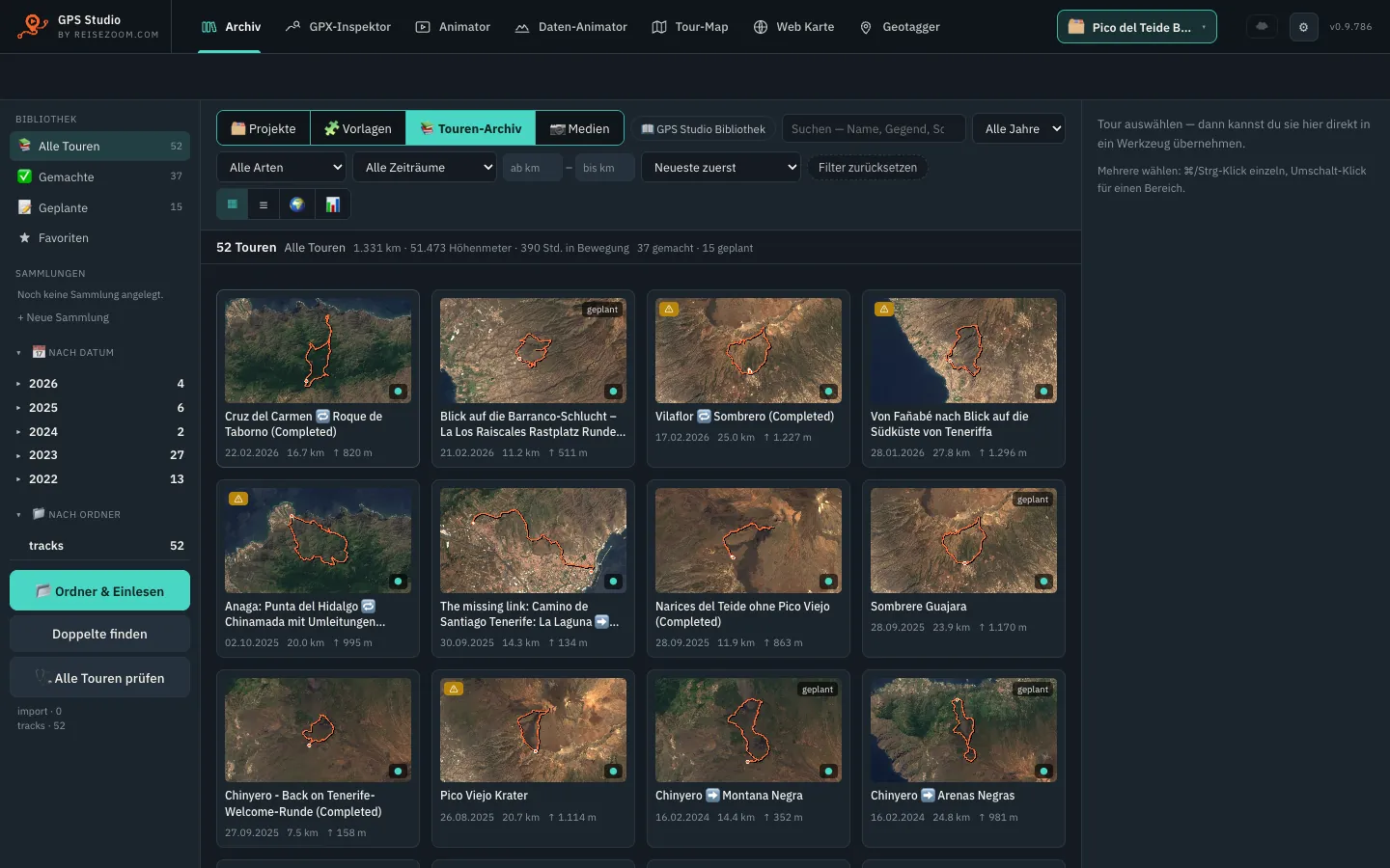
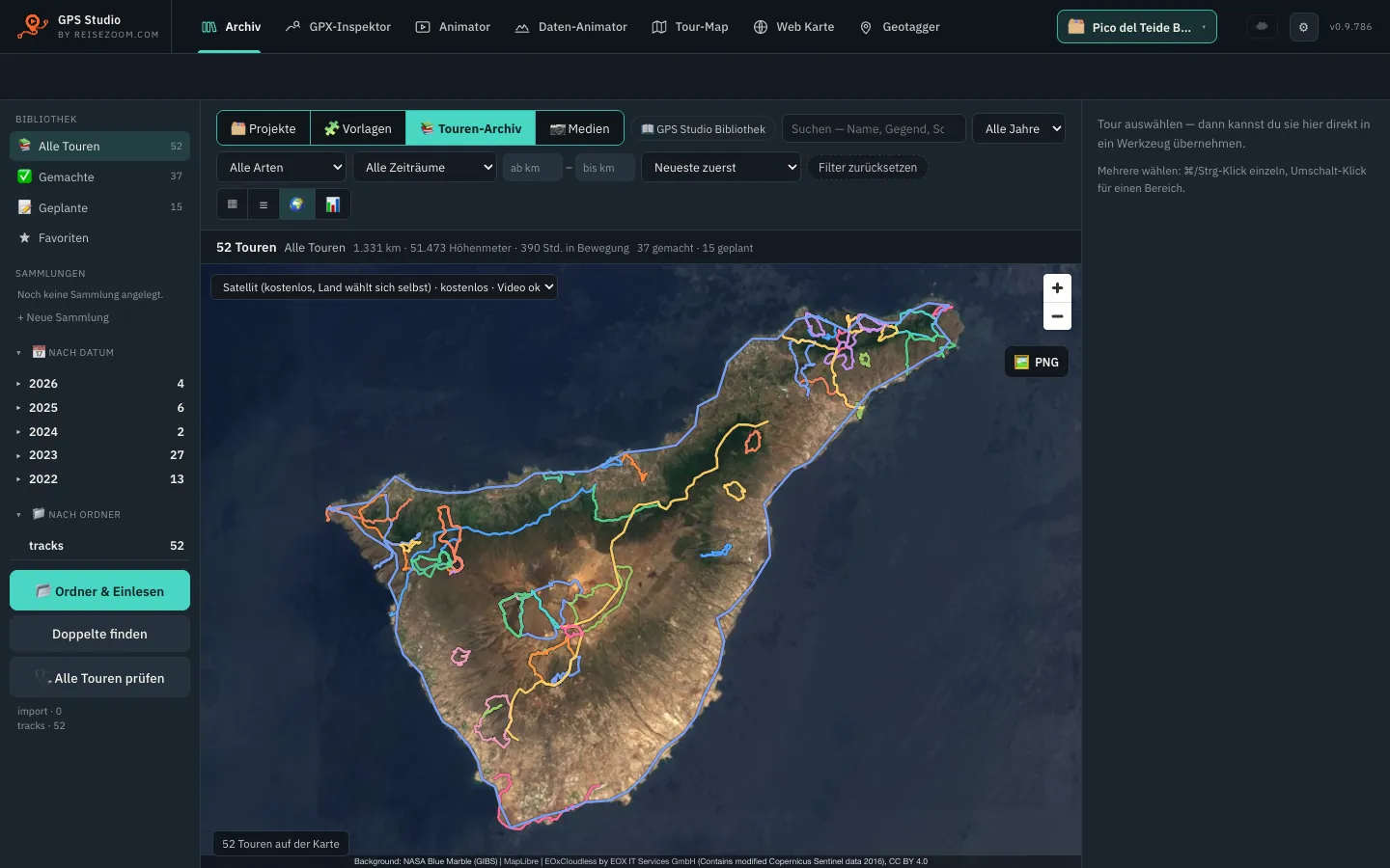
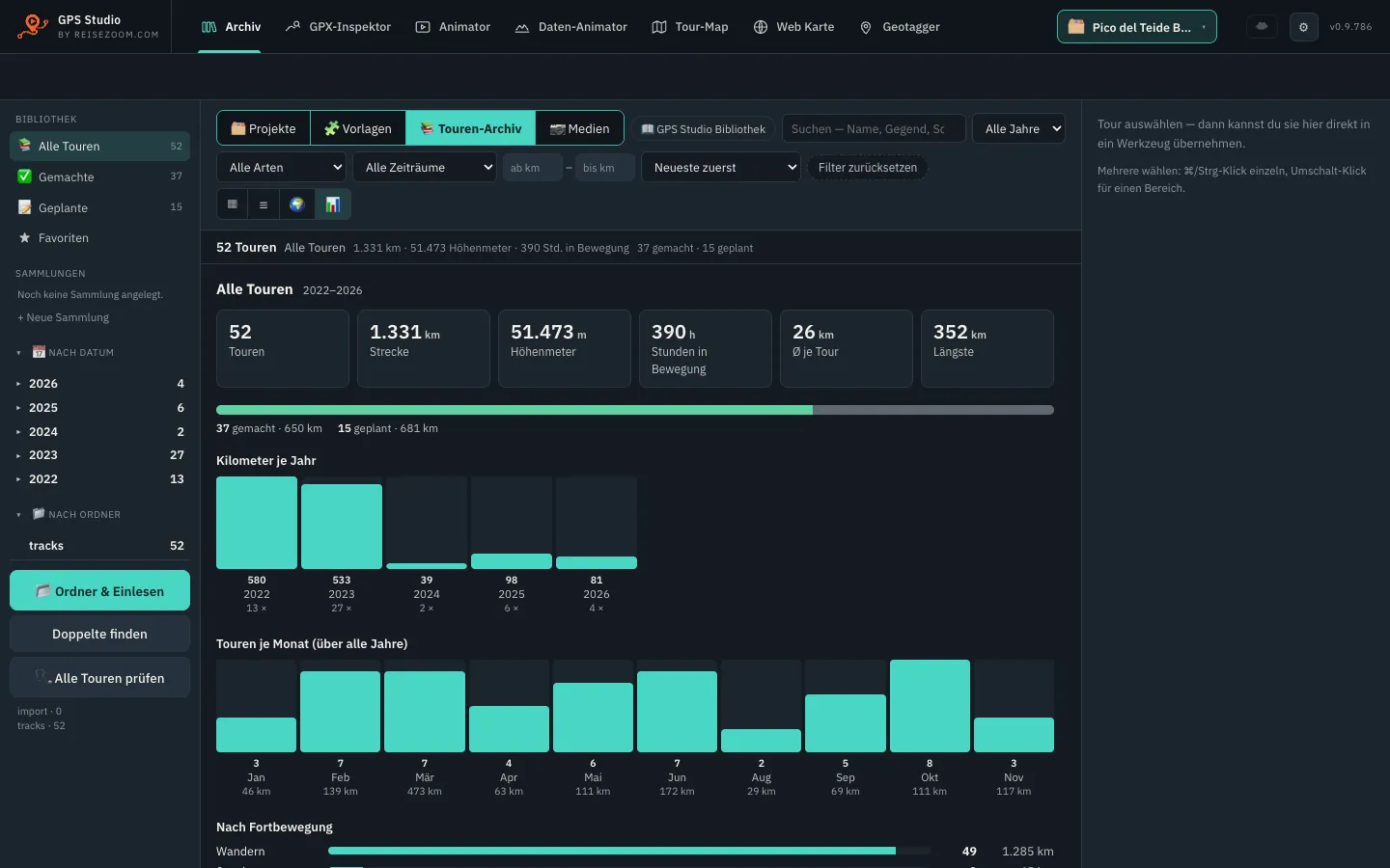
📚LibraryAll tours, photos and projects in one place — import, search, filter, map, statistics.Details
This is where the app starts. Tell it once where your tracks live and it reads them all — about 700 files in roughly 20 seconds on my machine. Every tour gets a map preview, date, distance and elevation gain.
- Four views: tiles for browsing, a list for comparing, a map (“where have I been?”) and statistics by year, month and ISO week.
- Search and filter by year, period, activity, length, name, tags and regions — even by places that appear in no file at all.
- Done or planned? The app tells from pauses, pace and timestamps; for the odd one out you switch it with one click.
- Track check: outliers, gaps and time jumps are flagged red or yellow; one click sends the tour to the Inspector for repair.
- Collections for multi-day trips — six stages of a long-distance trail become one video with a single click.
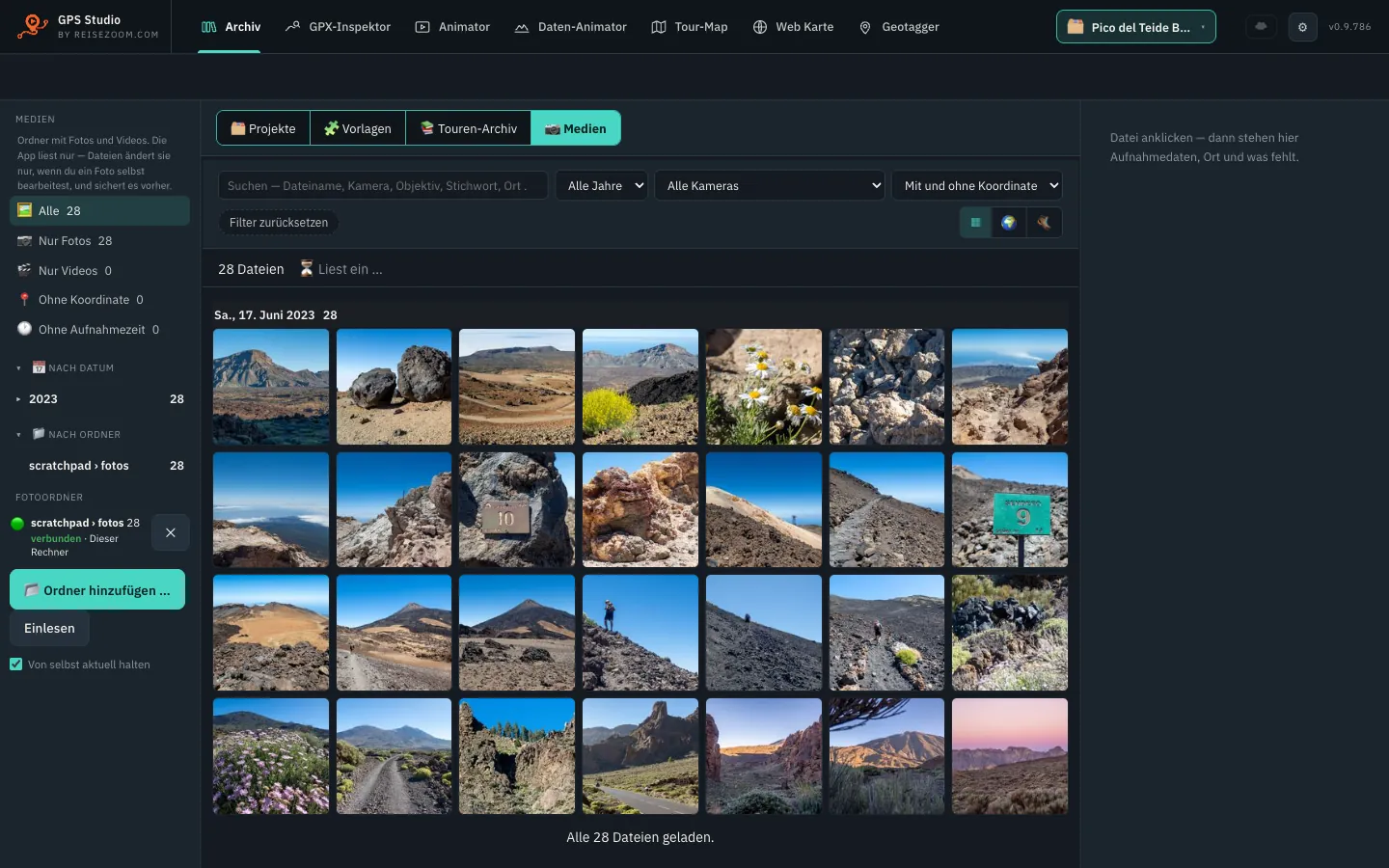
- Media: photos and videos from your folders, external drive or NAS, by day, folder, map or tour. Optional content search (“sunset”, “dog on the beach”) — entirely on your computer.
- Projects and templates: every video and image is a project with earlier versions. Templates keep your look for the next tour.
- Your own library: the app stores copies; your original folders stay as they are. Deleted items go to a recycle bin first.
🔍GPX InspectorCheck and repair tracks — outliers, gaps, elevation, start and end. Plus the tour’s logbook.Details
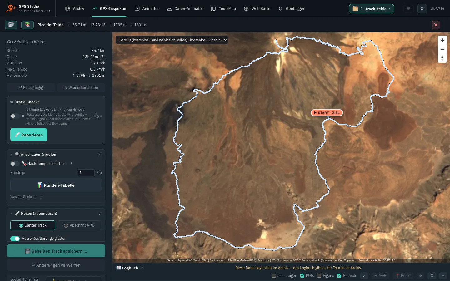
Somewhere the signal jumps, the walk from the car park is stuck to the start, or a section is missing because the watch paused. The Inspector shows every single point on the map and fixes what the recording got wrong.
- Auto-heal: finds outliers, gaps and time jumps, shows a preview first and explains every flagged point. Nothing changes until you click “Apply”.
- Fill gaps — straight, along a path or along a line you draw yourself.
- Move or delete points, one by one or as a range; trim start and end, reverse, split.
- Fix elevation: take it from the terrain model or remove a barometer’s drift.
- Join tracks: several daily files into one tour.
- Logbook: when you were moving, where you paused, the highest point, places and sights along the way. In the Animator you decide per section whether to show, speed up or skip it.
- Nothing is lost: saving creates a new version, the original stays. Timestamps survive smoothing.
🎬AnimatorYour track as a video over a 3D map — three clicks with Quick video, or down to the last detail.Details
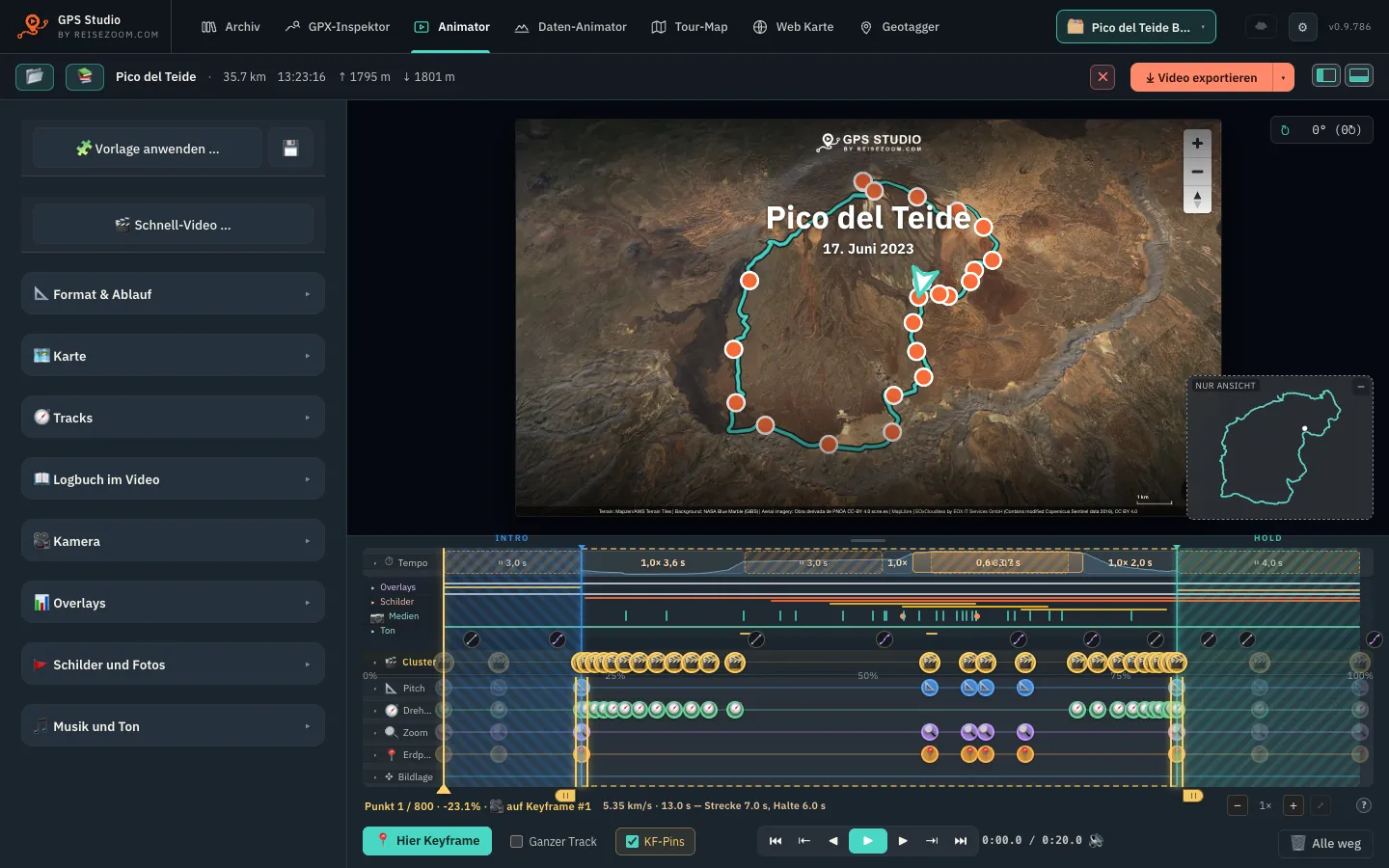
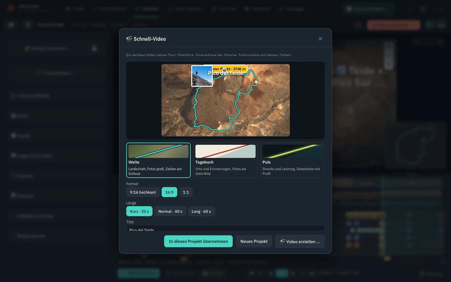
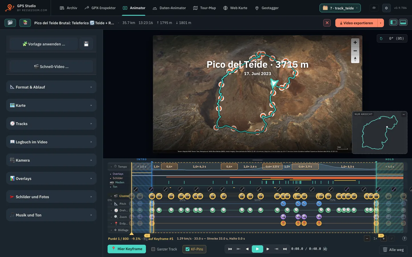
The line is drawn across a 3D map — as an intro, a reel or a keepsake of the tour. Two ways lead there: the Quick video with a few decisions, and the full Animator where you set every detail yourself. Both work on the same project.
- Quick video: template Wide, Diary or Pulse, format 16:9, 9:16 or 1:1, length 20, 40 or 60 seconds. The app suggests a title and picks the photos from your collection.
- Eight looks (Natural, Travel atlas, Night map, Minimal, Treasure map, Topo, Nautical, Pastel) match map, line and type — then change anything you like.
- Maps without keys: official aerial imagery from national mapping agencies, OpenFreeMap, OpenStreetMap, OpenTopoMap. With 3D terrain, 3D buildings, a fly-in from space and flights at real altitude.
- Camera: fixed, follow or camera flight — or the keyframe editor for pitch, bearing, zoom and position with smooth easing.
- A timeline like in a video editor: pace and holds, overlays, signs, media, sound and camera on their own tracks.
- Photos and clips land at the right spot by capture time. As a photo stop the video pauses, the camera moves in and the photo appears large with place and local time.
- Overlays and signs: live values, elevation profile, title, end card, overview map; signs for summits, places and highlights. Plus nine music tracks you may use freely.
- Several tours: one after another as a journey with cinematic transitions, or all at once as a swarm. Travel by car, train, ferry or plane as a stage with a vehicle.
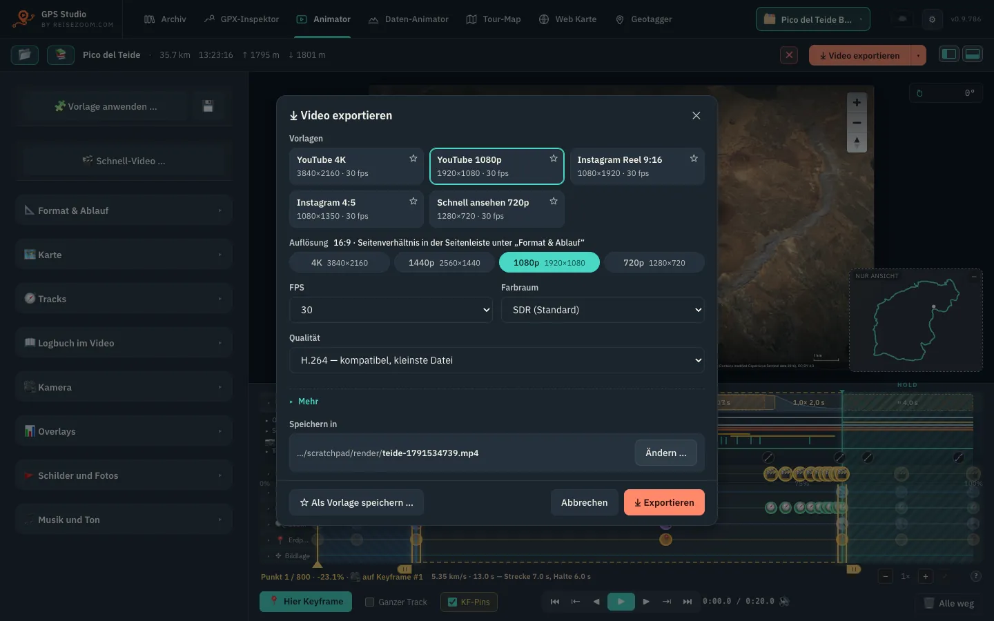
- Export: up to 4K, 24–60 fps, H.264, H.265, ProRes, optionally HDR or with alpha channel. The preview is the video — what you see is what you get.
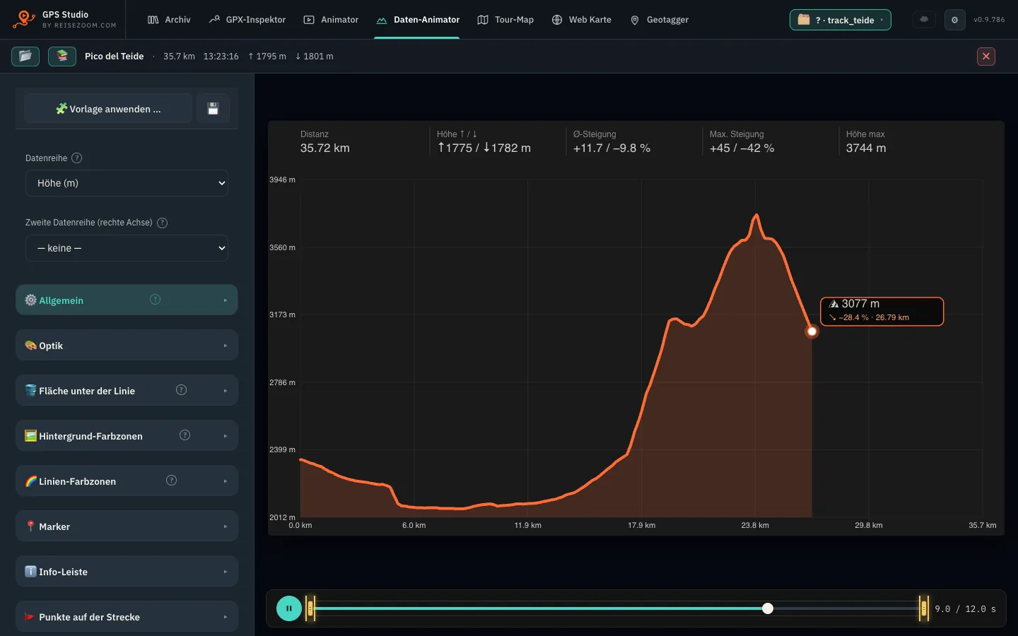
📈Data AnimatorElevation, heart rate, speed or power as a growing graph — perfect as an overlay in your video.Details
Every data series your track carries becomes an animated graph: the line grows step by step, in sync with the position on the tour. Where are we, and what was the body doing at that moment?
- Any series: elevation, speed and gradient from the positions; from FIT and TCX also heart rate, cadence, power and temperature.
- Two series at once on their own axes — heart rate over the elevation profile shows where the climb hurt.
- Points on the route: kilometre markers, photos, waypoints or your own marks right on the graph.
- Colour zones and smoothing for calm, readable curves.
- Alpha channel to lay it straight over your footage — or a self-running HTML file for your website.
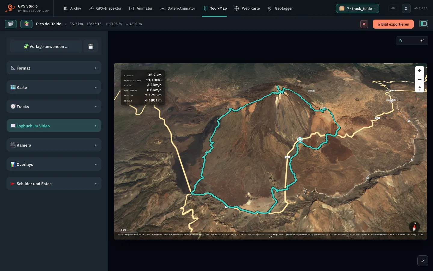
🗺️Tour MapYour tour as a map image (PNG) — for thumbnails, blog posts and social media.Details
Tour Map uses the same 3D map as the Animator but renders a single image. Done in two minutes — and you see right away whether your track is complete.
- Looks, map styles, terrain, buildings, signs and overlays just like in the Animator.
- Formats 16:9, 9:16 for Shorts and Reels, 1:1 for posts — at the resolution you choose.
- Start and finish markers, padding, orientation — whole journeys and swarms fit in one image too.
- From the Animator in one click: “Open as Tour Map” keeps framing and style.
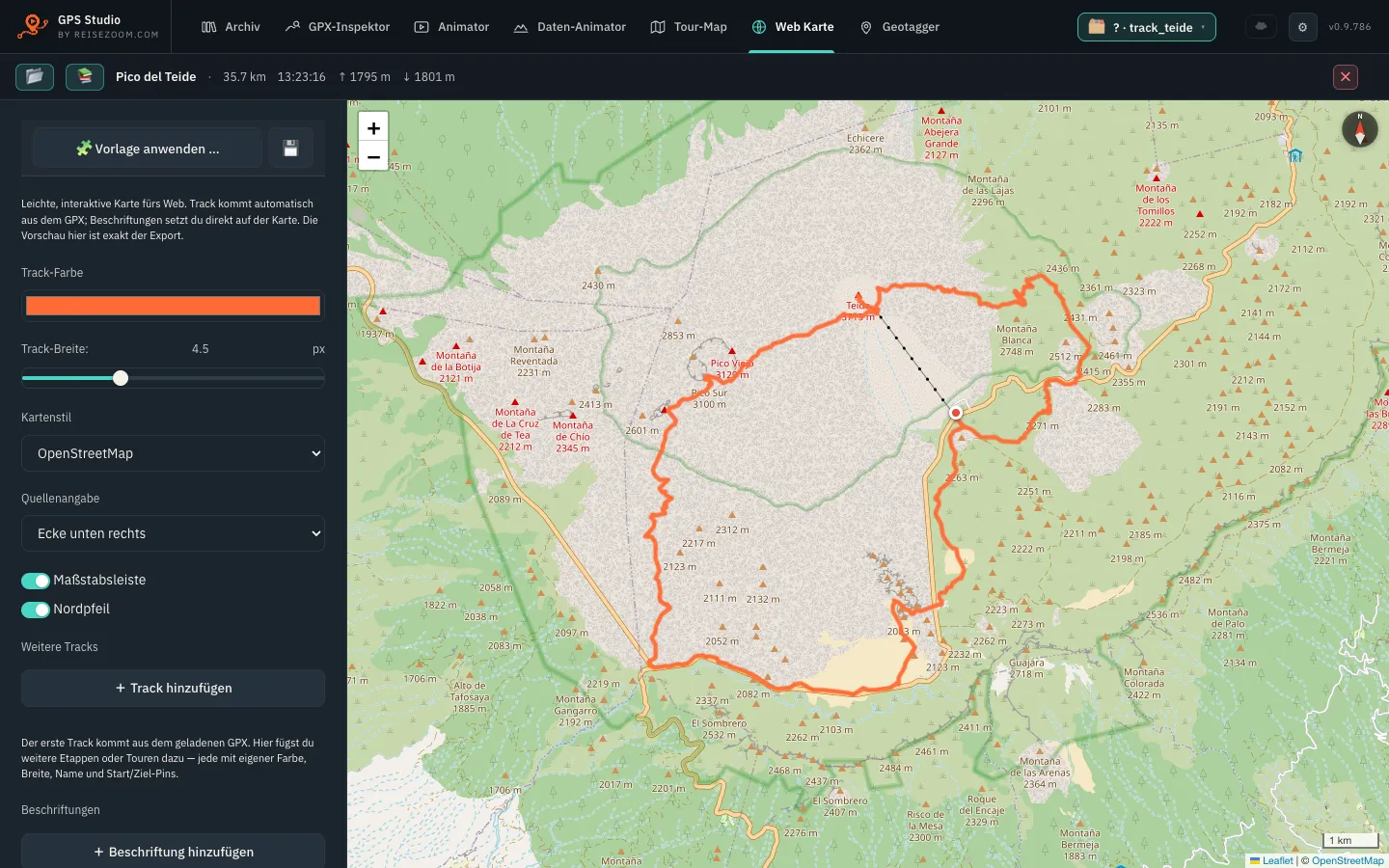
🌍Web MapAn interactive map for your website — a small HTML file, no cost per view.Details
Your readers zoom, pan and explore the route. The export is a small HTML file (about 40 KB) on OpenStreetMap — however many visitors come, it costs you nothing.
- Several tracks in one map, each with its own colour, width, name and start/finish markers.
- Labels placed right on the map.
- Privacy: optionally the map loads tiles only after a click — no reader’s IP address goes to the map provider unasked.
- On the web you get the same as “Share” with five blog widgets — the app adds it for tours from your library.
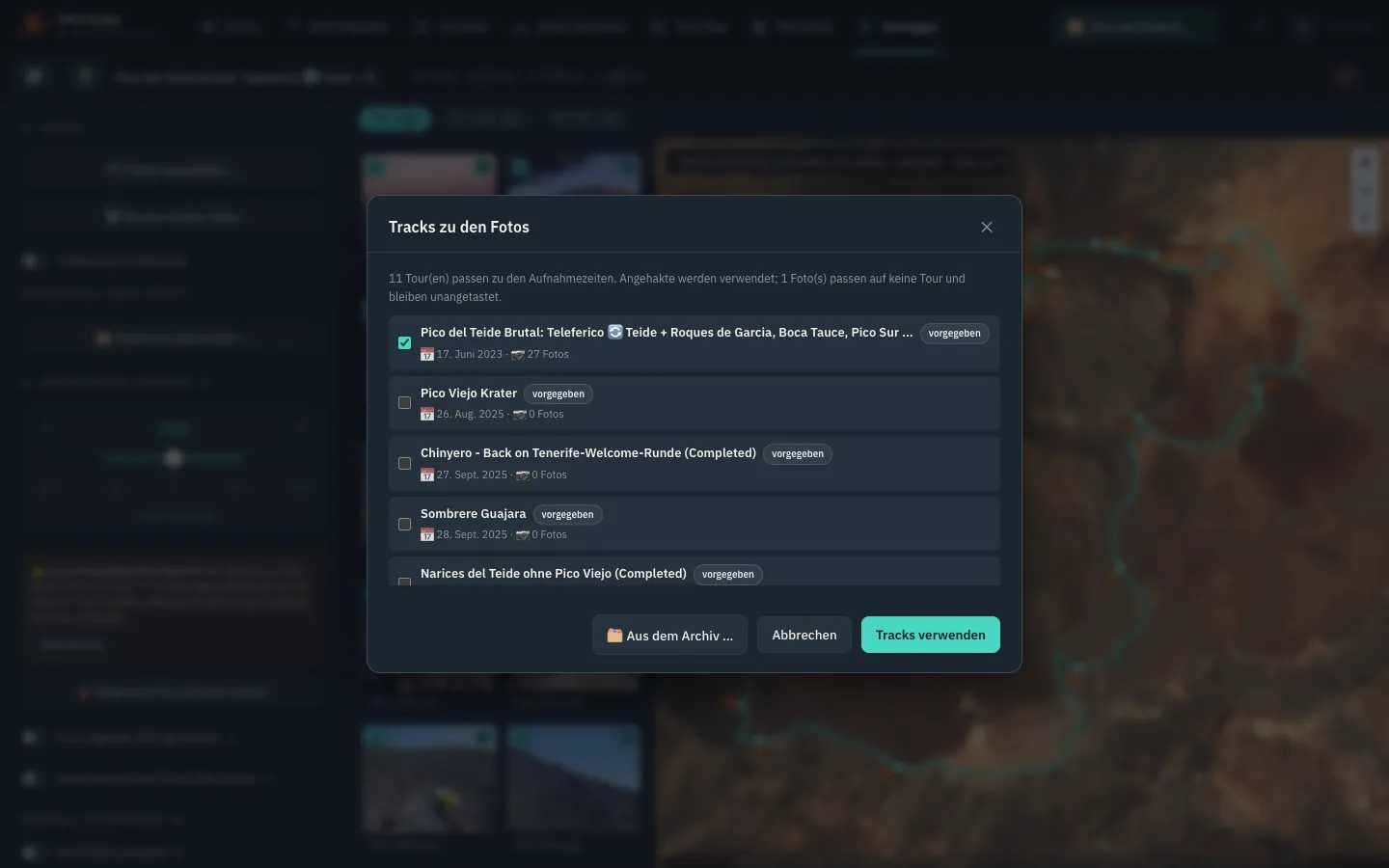
📍GeotaggerWrite GPS coordinates from the track into photos and videos — hundreds at once, RAW included.Details
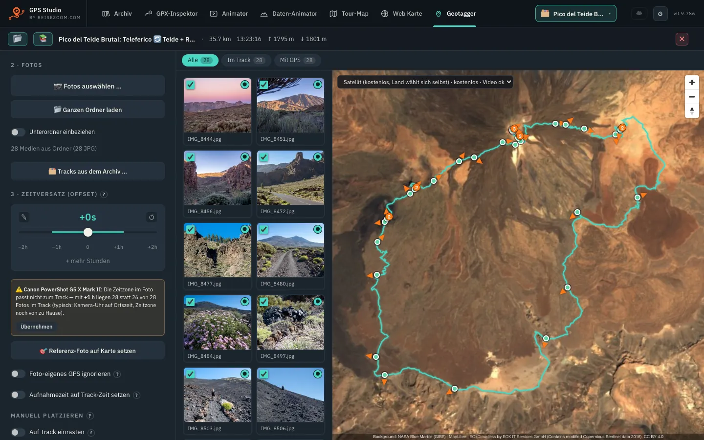
Most cameras have no GPS. After the tour you have a pile of photos without coordinates. The Geotagger matches every photo to its point on the track by capture time — my favourite feature.
- Drop in a folder, subfolders included — the library suggests the matching tracks itself, several at once.
- All formats: JPEG, TIFF, HEIC and RAW from all major brands (CR3, NEF, ARW, RAF, DNG …), plus videos (MP4, MOV, Insta360 INSV).
- Time zone automatic from the camera data or the track; fix a wrong camera clock with an offset or a reference photo.
- Uncertain positions in track gaps are flagged instead of silently guessed.
- More into EXIF: address (country, city), viewing direction with a compass on the map, author and copyright for the whole batch.
- Originals stay untouched — tagged photos are written as copies to a target folder. Afterwards Apple Photos, Lightroom and Capture One sort your images on the map.
Start on the web.
Carry on in the app.
You don’t have to decide up front. Start here in the browser — and when you want more, take everything into the app.
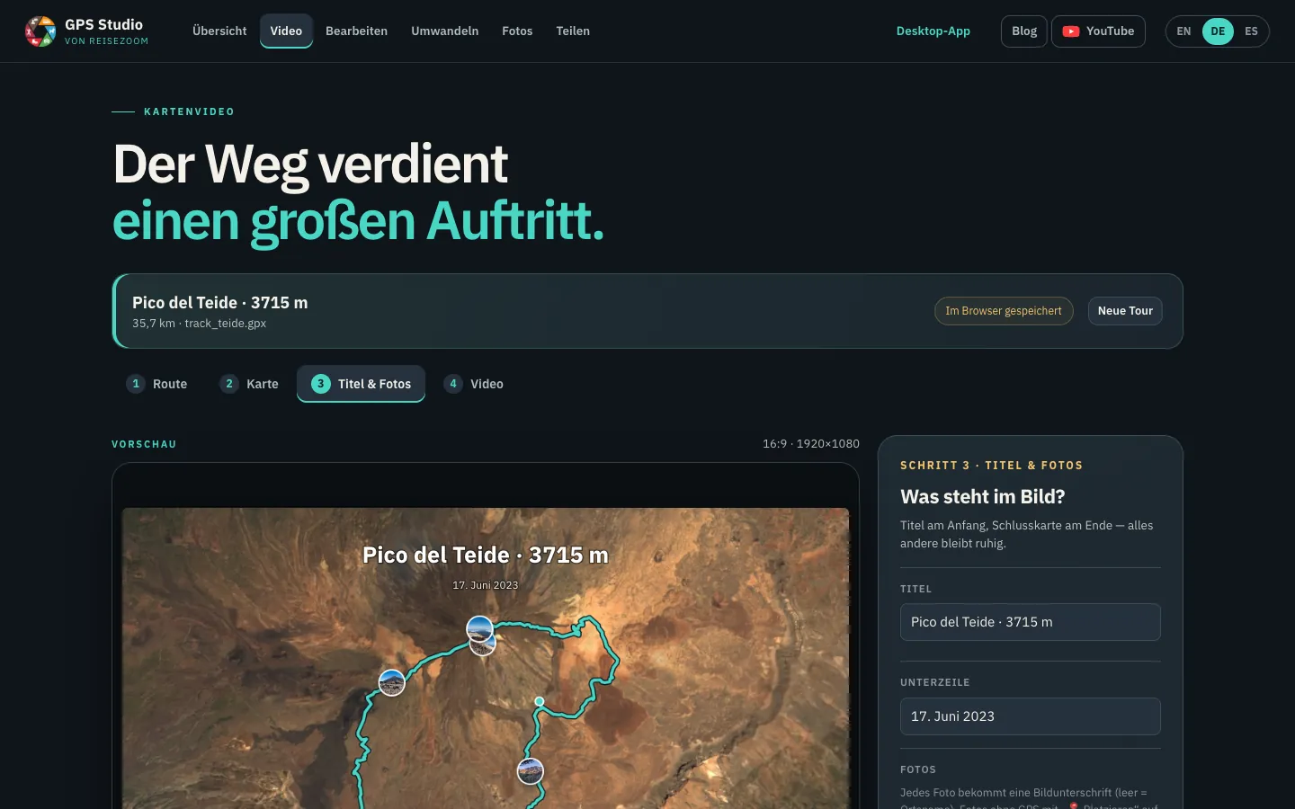
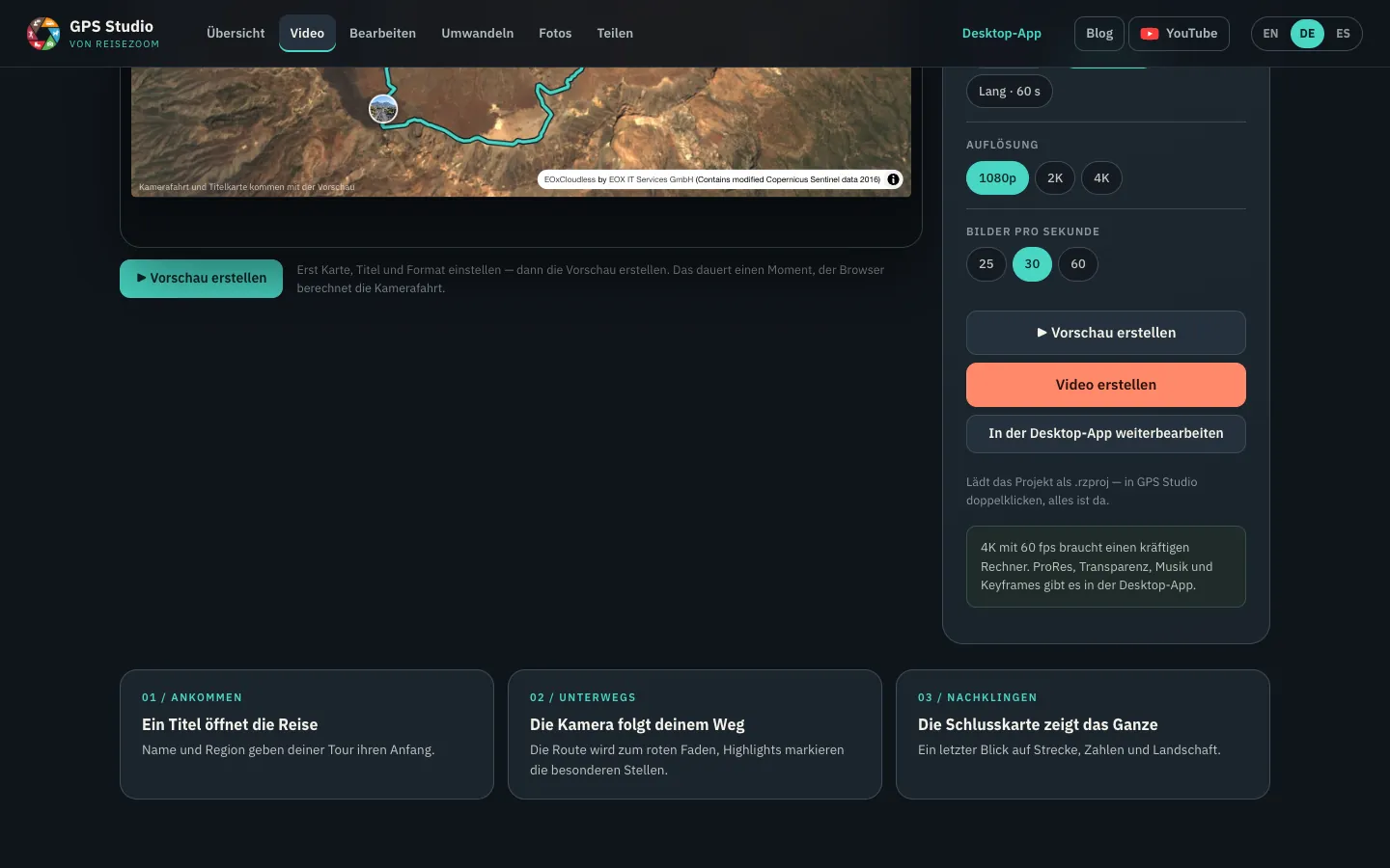
Load a track, pick a map, add a title and photos — in the web video studio, nothing to install.
“Continue in the desktop app” packs track, settings and photos into an .rzproj file.
Double-click the file (or drag it into the window) — the project opens in the Animator with everything in place. Carry on with keyframes, 4K, music and every map style.
And everything else from the web? The web tools produce ordinary files — GPX, KML, TCX, geotagged photos. The app opens them directly: drag the file into the window, done. And any tour you loaded here is still a file on your computer anyway.
What applies everywhere
Web or app?
| In the browser | Desktop app | |
|---|---|---|
| View, convert, edit a tour | ✓ | ✓ |
| Geotag photos | JPEG | JPEG, HEIC, RAW, videos |
| Map video | 8 looks, title, photos, up to 4K, up to 60 s | plus keyframes, music, photo stops, overlays, ProRes, transparency, several tours |
| Map for your blog | ✓ | ✓ (also for tours from the library) |
| Library for hundreds of tours and photos | — | ✓ |
| Repair tracks (Inspector) | single tools | ✓ with preview and logbook |
| Rendering video | only with the tab in front | in the background too, while you keep working |
| Installation | none | download once |
Read more
FAQ
Is it really free?
Yes — completely free, no account and no cloud. It runs locally on your computer.
Which systems?
Ready-made downloads for macOS with Apple Silicon (M1 or newer) and Windows 10/11. On Linux the app runs straight from the source code (Fedora, Debian, Ubuntu).
Which files can it read?
GPX, FIT, TCX, KML/KMZ, GeoJSON and more — the same formats as the web tools.
Do I need an account?
No. Download, open, drop in your track — done.
Can I continue in the app what I started on the web?
Yes. In the web video studio, “Continue in the desktop app” downloads an .rzproj file with track, settings and photos. Double-click it and the project opens in the app. GPX, KML and other files from the web tools open directly as well.
What about Linux?
There is no ready-made package — the app runs directly from the source code, nothing to compile: install the system packages (Python, GTK/WebKit, ffmpeg), clone the repository, then pip install -r requirements.txt and python app.py. Step by step in the README on GitHub.
All images and the video come from the real app (version 0.9.786), with my Teide tour from June 2023.